Geolokaliseren

Topografische kaart Baia Mare

Interactieve kaart

Klik op de kaart om de hoogte weer te geven.

Over deze kaart

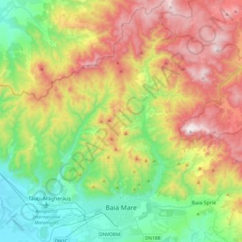
Naam: Topografische kaart Baia Mare, hoogte, reliëf.

Locatie: Baia Mare, Maramureș, Romania (47.62274 23.48205 47.85881 23.71164)

Gemiddelde hoogte: 592 m

Minimale hoogte: 145 m

Maximale hoogte: 1.306 m

The city is situated in the vicinity of the Gutâi and Igniș Mountains. Altitudes reach 1400 meters in some peaks. The area is famous for its outstanding landscapes, and the mountains are easily accessible from the city, famous routes being: Igniș (1307 m), Mogoșa (1246 m), Gutâi (1443 m), Creasta Cocoșului (1450 m), Piatra Soimului (839 m), Plestioara (803 m), Dealul Bulat (683 m), Murgau (633 m), Dealul Crucii (500 m) etc.

Wikipedia (CC-BY-SA 3.0)