
Topografische kaart Tlaxcalancingo
Interactieve kaart
Klik op de kaart om de hoogte weer te geven.
Over deze kaart
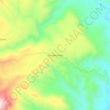
Naam: Topografische kaart Tlaxcalancingo, hoogte, reliëf.
Locatie: Tlaxcalancingo, Ixtacamaxtitlán, Puebla, México (19.62361 -97.92389 19.66361 -97.88389)
Gemiddelde hoogte: 2.411 m
Minimale hoogte: 2.199 m
Maximale hoogte: 2.736 m