
Topografische kaart Tumaco
Interactieve kaart
Klik op de kaart om de hoogte weer te geven.
Over deze kaart
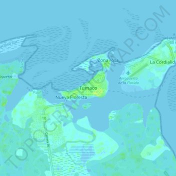
Naam: Topografische kaart Tumaco, hoogte, reliëf.
Locatie: Tumaco, Nariño, Colombia (1.76776 -78.81060 1.84776 -78.73060)
Gemiddelde hoogte: 1 m
Minimale hoogte: -3 m
Maximale hoogte: 11 m
Andere topografische kaarten
Klik op een kaart om zijn topografie, zijn hoogte en zijn reliëf te bekijken.
LA BRAVA - R?O GUANA
Colombia > Nariño > Tumaco > Kaunapi
LA BRAVA - R?O GUANA, Kaunapi, Tumaco, Pacífico Sur, Nariño, Colombia
Gemiddelde hoogte: 18 m