
Topografische kaart Perušić
Interactieve kaart
Klik op de kaart om de hoogte weer te geven.
Over deze kaart
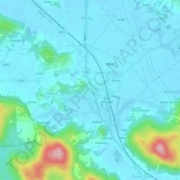
Naam: Topografische kaart Perušić, hoogte, reliëf.
Locatie: Perušić, Općina Perušić, Lika-Senj County, 53202, Croatia (44.62972 15.36300 44.66972 15.40300)
Gemiddelde hoogte: 599 m
Minimale hoogte: 569 m
Maximale hoogte: 771 m
Grabovača is a cave park situated between the Lika karstic plains and fields, 2 kilometres (1.2 mi) from the center of Perušić. It is 770 metres (2,530 ft) above sea level at the mid-elevations of the Velebit mountains, near the karst basin of the river Lika. In an area of 1.5 km2 (0.58 sq mi) there are an abundance of underground karst forms, complex calcite formations. The park represents one-quarter of the protected caves in Croatia. The caves are closed to the public in winter.