
Topografische kaart Virgin Gorda
Interactieve kaart
Klik op de kaart om de hoogte weer te geven.
Over deze kaart
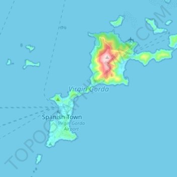
Naam: Topografische kaart Virgin Gorda, hoogte, reliëf.
Gemiddelde hoogte: 11 m
Minimale hoogte: -1 m
Maximale hoogte: 404 m
One of the great harbors of the world, North Sound, and historically Gorda Sound, lies at the northeast end of the island. It is bordered by four islands and connecting reef systems that keep the sound calm, creating one of the world's great watersports meccas, with over 3,000 acres (1,200 ha) of protected waters. At the eastern end of the sound is the premier anchorage, in the lee of Biras Hill (elevation 435 ft (133 m)). The village, resort, and marina at this point (Jon'O'Point) is called the Bitter End Yacht Club, and runs for about a mile of coastline.