
Topografische kaart Tombstone
Interactieve kaart
Klik op de kaart om de hoogte weer te geven.
Tombstone
The Tombstone District located at 31°42′57″N 110°3′53″W / 31.71583°N 110.06472°W / 31.71583; -110.06472 (31.715940, −110.064827) sits atop a mesa (elevation 4,539 feet (1,383 m)) in the San Pedro River valley between the Huachuca Mountains and Whetstone Mountains to the west, and the Mules and the Dragoon Mountains to the east. According to the United States Census Bureau, the city has a total area of 4.3 square miles (11.2 km2), all land.
Over deze kaart
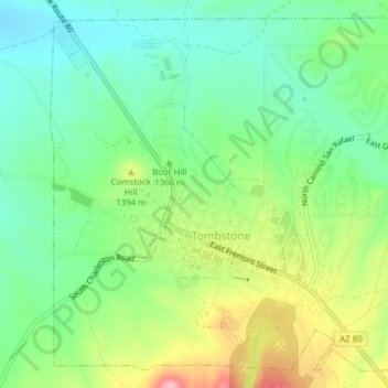
Naam: Topografische kaart Tombstone, hoogte, reliëf.
Locatie: Tombstone, Cochise County, Arizona, 85638, United States (31.70272 -110.08222 31.73268 -110.04366)
Gemiddelde hoogte: 1.362 m
Minimale hoogte: 1.304 m
Maximale hoogte: 1.468 m