
Topografische kaart Kampung Sungai Bari
Interactieve kaart
Klik op de kaart om de hoogte weer te geven.
Over deze kaart
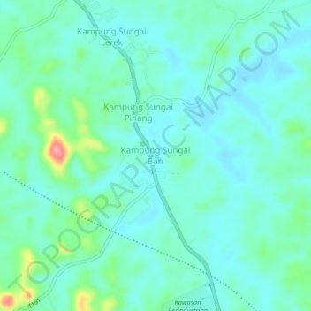
Naam: Topografische kaart Kampung Sungai Bari, hoogte, reliëf.
Locatie: Kampung Sungai Bari, Terengganu, Malaysia (5.38751 102.83610 5.42751 102.87610)
Gemiddelde hoogte: 26 m
Minimale hoogte: 5 m
Maximale hoogte: 110 m