
Topografische kaart Bouillon
Interactieve kaart
Klik op de kaart om de hoogte weer te geven.
Over deze kaart
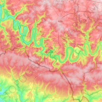
Naam: Topografische kaart Bouillon, hoogte, reliëf.
Locatie: Bouillon, Neufchâteau, Luxemburg, Wallonië, België (49.70920 4.96844 49.88368 5.18994)
Gemiddelde hoogte: 342 m
Minimale hoogte: 168 m
Maximale hoogte: 455 m
Andere topografische kaarten
Klik op een kaart om zijn topografie, zijn hoogte en zijn reliëf te bekijken.