
Topografische kaart Sindhanur
Interactieve kaart
Klik op de kaart om de hoogte weer te geven.
Sindhanur
Sindhanur is located at 15°47′N 76°46′E / 15.78°N 76.77°E / 15.78; 76.77. Sindhanur is a City and City Municipal Council located in Raichur District in the state of Karnataka. Residents prefer the many amenities found in Sindhanur over other district zones in Karnataka. Sindhanur city has 37,040 households and is divided into 31 wards. It has food services like Swiggy. Sindhanur city elections are held every 5 years to elect a representative of each ward. It has an average elevation of 377 metres (1,237 ft), and its area is 1,567.70 km2 (605.29 sq mi).
Over deze kaart
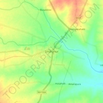
Naam: Topografische kaart Sindhanur, hoogte, reliëf.
Gemiddelde hoogte: 390 m
Minimale hoogte: 370 m
Maximale hoogte: 413 m