
Topografische kaart Santa Marta
Interactieve kaart
Klik op de kaart om de hoogte weer te geven.
Over deze kaart
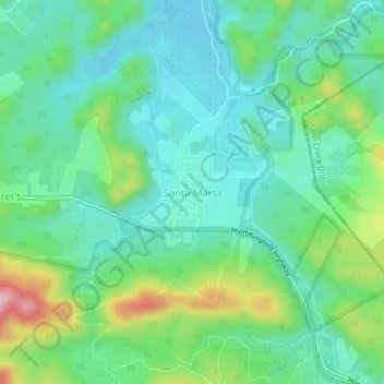
Naam: Topografische kaart Santa Marta, hoogte, reliëf.
Locatie: Santa Marta, Cayo District, Cayo, Belize (17.07202 -88.63190 17.11202 -88.59190)
Gemiddelde hoogte: 137 m
Minimale hoogte: 66 m
Maximale hoogte: 325 m