
Topografische kaart Fort McMurray
Interactieve kaart
Klik op de kaart om de hoogte weer te geven.
Over deze kaart
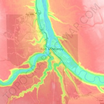
Naam: Topografische kaart Fort McMurray, hoogte, reliëf.
Locatie: Fort McMurray, Division No. 16, Alberta, Canada (56.64375 -111.51094 56.80447 -111.20705)
Gemiddelde hoogte: 345 m
Minimale hoogte: 234 m
Maximale hoogte: 422 m
The community lies at a lower elevation than most other parts of Alberta, so under the right conditions it can be a "hot spot" for Alberta.