
Topografische kaart Newcastle Ward 5
Interactieve kaart
Klik op de kaart om de hoogte weer te geven.
Over deze kaart
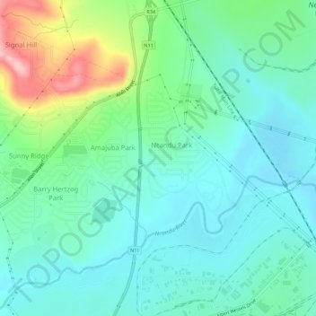
Naam: Topografische kaart Newcastle Ward 5, hoogte, reliëf.
Gemiddelde hoogte: 1.220 m
Minimale hoogte: 1.175 m
Maximale hoogte: 1.355 m
Andere topografische kaarten
Klik op een kaart om zijn topografie, zijn hoogte en zijn reliëf te bekijken.
Newcastle Local Municipality
Zuid-Afrika > KwaZulu-Natal > Newcastle Local Municipality
Newcastle Local Municipality, Amajuba District Municipality, KwaZulu-Natal, 2940, Zuid-Afrika
Gemiddelde hoogte: 1.536 m