
Topografische kaart Nevils
Interactieve kaart
Klik op de kaart om de hoogte weer te geven.
Over deze kaart
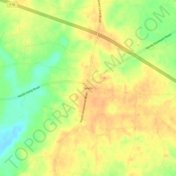
Naam: Topografische kaart Nevils, hoogte, reliëf.
Locatie: Nevils, Bulloch County, Georgia, United States (32.24380 -81.78095 32.28380 -81.74095)
Gemiddelde hoogte: 51 m
Minimale hoogte: 29 m
Maximale hoogte: 63 m
Andere topografische kaarten
Klik op een kaart om zijn topografie, zijn hoogte en zijn reliëf te bekijken.
Brooklet
United States > Georgia > Bulloch County
Brooklet, Bulloch County, Georgia, United States
Gemiddelde hoogte: 49 m
Stadium Walk
United States > Georgia > Bulloch County > Statesboro > Stadium Walk
Stadium Walk, Statesboro, Bulloch County, Georgia, 30460, United States
Gemiddelde hoogte: 63 m