
Topografische kaart Niles
Interactieve kaart
Klik op de kaart om de hoogte weer te geven.
Over deze kaart
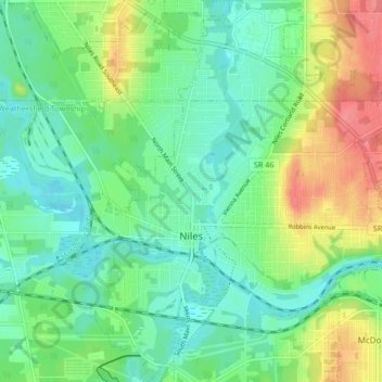
Naam: Topografische kaart Niles, hoogte, reliëf.
Locatie: Niles, Trumbull County, Ohio, 44446, United States (41.15662 -80.78810 41.21974 -80.71705)
Gemiddelde hoogte: 280 m
Minimale hoogte: 256 m
Maximale hoogte: 327 m
Andere topografische kaarten
Klik op een kaart om zijn topografie, zijn hoogte en zijn reliëf te bekijken.
Vienna Township
United States > Ohio > Trumbull County
Vienna Township, Trumbull County, Ohio, 44473, United States
Gemiddelde hoogte: 342 m
Burghill
United States > Ohio > Trumbull County > Burghill
Burghill, Trumbull County, Ohio, 44404, United States
Gemiddelde hoogte: 310 m
Newton Falls
United States > Ohio > Trumbull County
Newton Falls, Trumbull County, Ohio, United States
Gemiddelde hoogte: 283 m