
Topografische kaart Amble
Interactieve kaart
Klik op de kaart om de hoogte weer te geven.
Over deze kaart
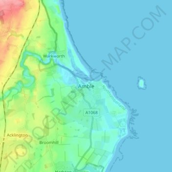
Naam: Topografische kaart Amble, hoogte, reliëf.
Gemiddelde hoogte: 15 m
Minimale hoogte: -2 m
Maximale hoogte: 85 m
Samuel Lewis reported a township population of 247 in 1831. By the seventh edition of his Topographical Dictionary of England, which was published in 1848, this figure had risen to 724. The population was reported as being 1,040 in 1851. The 1871 census recorded a population of 1,233, spread among 233 houses.