
Topografische kaart Tinian Island
Interactieve kaart
Klik op de kaart om de hoogte weer te geven.
Over deze kaart
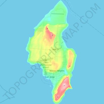
Naam: Topografische kaart Tinian Island, hoogte, reliëf.
Gemiddelde hoogte: 17 m
Minimale hoogte: 0 m
Maximale hoogte: 187 m
Tinian is about 5 nautical miles (9.3 km) southwest of Saipan, from which it is separated by the Saipan Channel. It has a land area of 39 square miles (100 km2), with its highest elevation at Mount Lasso at 171 meters (561 ft).