
Topografische kaart Montgomery
Interactieve kaart
Klik op de kaart om de hoogte weer te geven.
Over deze kaart
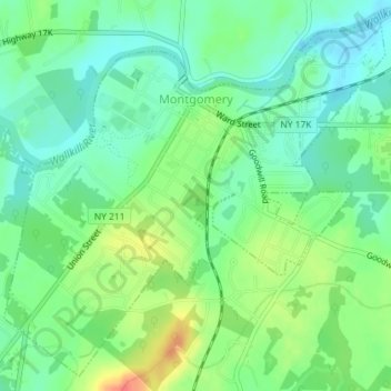
Naam: Topografische kaart Montgomery, hoogte, reliëf.
Gemiddelde hoogte: 118 m
Minimale hoogte: 99 m
Maximale hoogte: 151 m
These lands in the west are the lowest-lying in the village. Much of its topography rises gently from the river, with little relief save the Academy Hill area on the east edge of downtown where the village hall is located, and a 455-foot (139 m) hill at the junction of Purple Martin Road and Cardinal Drive that is the highest point in the village, marked by a water tower.