
Topografische kaart Gannan
Interactieve kaart
Klik op de kaart om de hoogte weer te geven.
Gannan
Gannan, as illustrated by this chart for Xiahe, has an alpine subarctic climate (Köppen Dwc) that grades into an alpine climate (ETH) at the highest elevations. The climate is characterised by mild, rainy summers and frigid, but dry and sunny, winters.
Over deze kaart
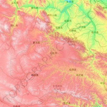
Naam: Topografische kaart Gannan, hoogte, reliëf.
Gemiddelde hoogte: 3.075 m
Minimale hoogte: 1.621 m
Maximale hoogte: 4.740 m