
Topografische kaart Costa Oriental del Lago
Interactieve kaart
Klik op de kaart om de hoogte weer te geven.
Over deze kaart
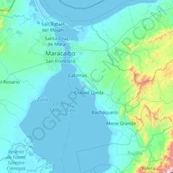
Naam: Topografische kaart Costa Oriental del Lago, hoogte, reliëf.
Gemiddelde hoogte: 162 m
Minimale hoogte: -7 m
Maximale hoogte: 3.168 m