
Topografische kaart Columbia Icefield
Interactieve kaart
Klik op de kaart om de hoogte weer te geven.
Columbia Icefield
Columbia Icefield has a alpine climate (Köppen: ETf), because the weather station is located at an altitude of 1,981.20 m (6,500 ft). The average annual temperature is −2.1 °C (28.2 °F). The month of July is the warmest with an average temperature of 9.1 °C (48.38 °F).
Over deze kaart
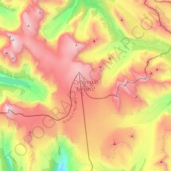
Naam: Topografische kaart Columbia Icefield, hoogte, reliëf.
Gemiddelde hoogte: 2.484 m
Minimale hoogte: 1.193 m
Maximale hoogte: 3.746 m