
Topografische kaart Santo Domingo
Interactieve kaart
Klik op de kaart om de hoogte weer te geven.
Over deze kaart
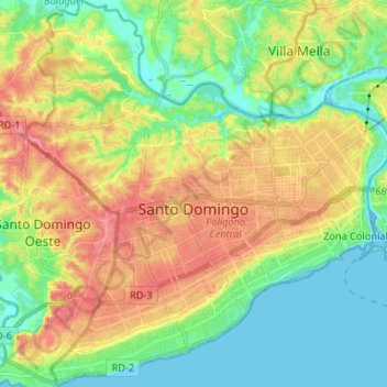
Naam: Topografische kaart Santo Domingo, hoogte, reliëf.
Locatie: Santo Domingo, Distrito Nacional, Dominicaanse Republiek (18.42274 -69.99928 18.54759 -69.87451)
Gemiddelde hoogte: 30 m
Minimale hoogte: -3 m
Maximale hoogte: 70 m