
Topografische kaart Greenwood
Interactieve kaart
Klik op de kaart om de hoogte weer te geven.
Over deze kaart
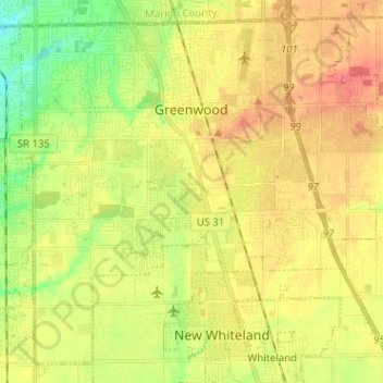
Naam: Topografische kaart Greenwood, hoogte, reliëf.
Locatie: Greenwood, Johnson County, Indiana, United States (39.54837 -86.16704 39.63693 -86.04000)
Gemiddelde hoogte: 245 m
Minimale hoogte: 216 m
Maximale hoogte: 270 m
Greenwood's mean elevation is 813 feet (248 m) above sea level. The city's topography is flat to gently rolling.
Andere topografische kaarten
Klik op een kaart om zijn topografie, zijn hoogte en zijn reliëf te bekijken.
Johnson County
United States > Indiana > Johnson County
Johnson County, Indiana, United States
Gemiddelde hoogte: 232 m
Banta
United States > Indiana > Johnson County > Bargersville
Banta, Bargersville, Johnson County, Indiana, United States
Gemiddelde hoogte: 232 m