
Topografische kaart Cumberland Island National Seashore
Interactieve kaart
Klik op de kaart om de hoogte weer te geven.
Over deze kaart
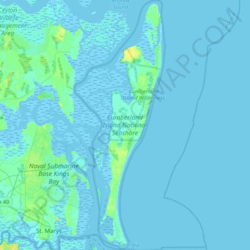
Naam: Topografische kaart Cumberland Island National Seashore, hoogte, reliëf.
Gemiddelde hoogte: 1 m
Minimale hoogte: -4 m
Maximale hoogte: 21 m
Andere topografische kaarten
Klik op een kaart om zijn topografie, zijn hoogte en zijn reliëf te bekijken.
St. Marys
United States > Georgia > Camden County > St. Marys
St. Marys, Camden County, Georgia, United States
Gemiddelde hoogte: 3 m