

Topografische kaart Kadapa
Klik op de kaart om de hoogte weer te geven.
Kadapa
Kadapa in the Rayalaseema region of Andhra Pradesh is located at 14°28′N 78°49′E / 14.47°N 78.82°E / 14.47; 78.82 about 412 km from Hyderabad, 260 km from Chennai, 250 km from Bangalore and 360 km from Vijayawada. The city is situated in the Bugga vanka or Ralla Vanka rivers bordered by the Palakondas to the south and to the east by a patch of hills casting north for the Lankamalas on Penna's other side. It has an average elevation of 138 metres (452 ft). Veligonda hills separates the districts of Nellore and Kadapa.
Over deze kaart
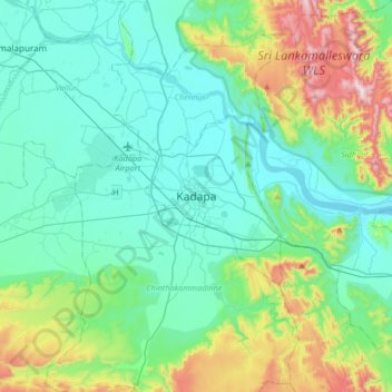
Naam: Topografische kaart Kadapa, hoogte, reliëf.
Locatie: Kadapa, YSR Kadapa, Andhra Pradesh, 516001, India (14.31529 78.66169 14.63529 78.98169)
Gemiddelde hoogte: 257 m
Minimale hoogte: 102 m
Maximale hoogte: 814 m