
Topografische kaart Rockfall
Interactieve kaart
Klik op de kaart om de hoogte weer te geven.
Rockfall
Middlesex County was created on May 2, 1785, from Hartford and New Haven counties. The county was named for Middlesex, England. Middlesex County is in south-central Connecticut. It is bordered to the south by Long Island Sound and to the southwest by the Hammonasset River, and the Connecticut River bisects the county from north to south. Other waterways are the Menunketesuck River, the Moodus Reservoir, and Bashan Lake. The topography is mostly upland terrain, with river valleys and coastal lowlands. Parklands include Cockaponset State Forest, Meshomasic State Forest Preserve, and Hurd and Devil's Hopyard state parks.
Over deze kaart
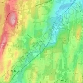
Naam: Topografische kaart Rockfall, hoogte, reliëf.
Gemiddelde hoogte: 75 m
Minimale hoogte: 10 m
Maximale hoogte: 161 m