
Topografische kaart Lac Noir
Interactieve kaart
Klik op de kaart om de hoogte weer te geven.
Over deze kaart
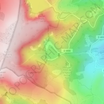
Naam: Topografische kaart Lac Noir, hoogte, reliëf.
Gemiddelde hoogte: 1.052 m
Minimale hoogte: 730 m
Maximale hoogte: 1.297 m
Lac Noir is a lake in Orbey, Alsace, France. At an elevation of 955 m, its surface area is 0.14 km².