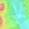
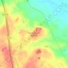
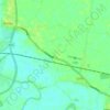
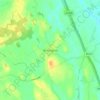
Topografische kaart Crambe
Klik op de kaart om de hoogte weer te geven.
Crambe
The village is at an elevation of 160 feet (49 m) above sea level, lies 0.6 miles (0.97 km) from the A64 road and within a bend in the River Derwent, Yorkshire. The nearest settlements to Crambe are Kirkham 0.5 miles (0.8 km) to the north-east; Whitwell-on-the-Hill 0.9 miles (1.4 km) to the north-west; Barton Hill 1.6 miles (2.6 km) to the south-west and Howsham 1.43 miles (2.30 km) to the south. It is also near Kirkham Priory, Howsham Hall, and Castle Howard.
Over deze kaart

Naam: Topografische kaart Crambe, hoogte, reliëf.
Gemiddelde hoogte: 36 m
Minimale hoogte: 9 m
Maximale hoogte: 93 m
Andere topografische kaarten
Klik op een kaart om zijn topografie, zijn hoogte en zijn reliëf te bekijken.




Harrogate
United Kingdom > England > North Yorkshire
Harrogate is situated on the edge of the Yorkshire Dales, with the Vale of York to the east and the upland Yorkshire Dales to the west and north-west. It has a dry and mild climate, typical of places in the rain shadow of the Pennines. It is on the A59 from Skipton to York. At an altitude of between 100 and…
Gemiddelde hoogte: 106 m


















Bolton Castle
United Kingdom > England > North Yorkshire > Redmire > Castle Bolton
Gemiddelde hoogte: 250 m


Thimbleby & Osmotherly Show field
United Kingdom > England > North Yorkshire > Thimbleby
Gemiddelde hoogte: 152 m








Killinghall
United Kingdom > England > North Yorkshire > Harrogate > Killinghall
Gemiddelde hoogte: 86 m



Ribblesdale
United Kingdom > England > North Yorkshire > Horton in Ribblesdale
Gemiddelde hoogte: 368 m