
Topografische kaart Brian Head
Interactieve kaart
Klik op de kaart om de hoogte weer te geven.
Brian Head
The community, at an elevation of 9,800 feet (3,000 m) above sea level, is the highest town in Utah. It is located on State Route 143 and is east of Interstate 15. Brian Head is approximately three miles north of Cedar Breaks National Monument.
Over deze kaart
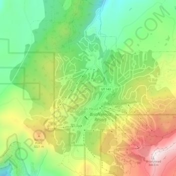
Naam: Topografische kaart Brian Head, hoogte, reliëf.
Locatie: Brian Head, Iron County, Utah, 84719, United States (37.67687 -112.86085 37.71835 -112.81521)
Gemiddelde hoogte: 3.031 m
Minimale hoogte: 2.729 m
Maximale hoogte: 3.449 m