
Topografische kaart Hogan
Interactieve kaart
Klik op de kaart om de hoogte weer te geven.
Over deze kaart
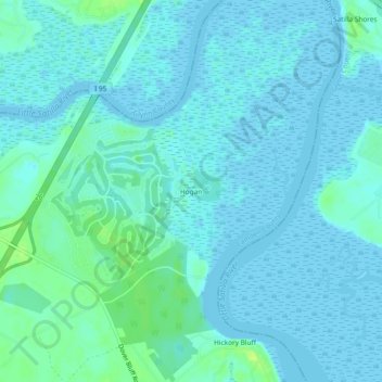
Naam: Topografische kaart Hogan, hoogte, reliëf.
Locatie: Hogan, Camden County, Georgia, United States (31.08769 -81.59603 31.12769 -81.55603)
Gemiddelde hoogte: 3 m
Minimale hoogte: -1 m
Maximale hoogte: 15 m
Andere topografische kaarten
Klik op een kaart om zijn topografie, zijn hoogte en zijn reliëf te bekijken.
The Lakes
United States > Georgia > Camden County > Kingsland
The Lakes, Kingsland, Camden County, Georgia, 31548, United States
Gemiddelde hoogte: 7 m
Piney Bluff
United States > Georgia > Camden County
Piney Bluff, Camden County, Georgia, United States
Gemiddelde hoogte: 2 m