
Topografische kaart Mamidipally
Interactieve kaart
Klik op de kaart om de hoogte weer te geven.
Over deze kaart
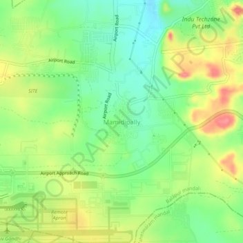
Naam: Topografische kaart Mamidipally, hoogte, reliëf.
Locatie: Mamidipally, Balapur mandal, Rangareddy, Telangana, India (17.22930 78.43144 17.26930 78.47144)
Gemiddelde hoogte: 606 m
Minimale hoogte: 572 m
Maximale hoogte: 650 m
Andere topografische kaarten
Klik op een kaart om zijn topografie, zijn hoogte en zijn reliëf te bekijken.
Kurmalguda
India > Telangana > Balapur mandal
Kurmalguda, Balapur mandal, Ranga Reddy District, Telangana, 500021, India
Gemiddelde hoogte: 567 m