
Topografische kaart Villanubla
Interactieve kaart
Klik op de kaart om de hoogte weer te geven.
Over deze kaart
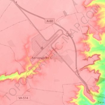
Naam: Topografische kaart Villanubla, hoogte, reliëf.
Locatie: Villanubla, Valladolid, Castilla y León, 47620, España (41.66796 -4.90903 41.73731 -4.78653)
Gemiddelde hoogte: 836 m
Minimale hoogte: 735 m
Maximale hoogte: 853 m