
Topografische kaart Santa Pau
Interactieve kaart
Klik op de kaart om de hoogte weer te geven.
Over deze kaart
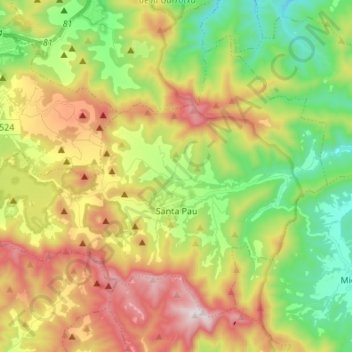
Naam: Topografische kaart Santa Pau, hoogte, reliëf.
Locatie: Santa Pau, Garrotxa, Gerona, Cataluña, 17811, España (42.11671 2.49372 42.19442 2.63023)
Gemiddelde hoogte: 541 m
Minimale hoogte: 212 m
Maximale hoogte: 1.004 m