
Topografische kaart Semmes
Interactieve kaart
Klik op de kaart om de hoogte weer te geven.
Semmes
Semmes is located at 30.778N, -88.259W. Elevation is 256 feet. The Semmes area is bounded to the North by the Citronelle area, bounded to the East by the cities of Saraland and Prichard, bounded to the South by the city of Mobile, and finally bounded to the West by Big Creek Lake.
Over deze kaart
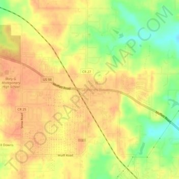
Naam: Topografische kaart Semmes, hoogte, reliëf.
Locatie: Semmes, Mobile County, Alabama, 36575, United States (30.75869 -88.27884 30.79869 -88.23884)
Gemiddelde hoogte: 68 m
Minimale hoogte: 40 m
Maximale hoogte: 82 m