
Topografische kaart Huesca
Interactieve kaart
Klik op de kaart om de hoogte weer te geven.
Huesca
Huesca lies on a plateau in the northern region of Aragón, with an elevation of 488 m (1,601.05 ft) above sea level. Close to the city lie the Sierra de Guara mountains, which reach 2,077 m. The geographical coordinates of the city are: 42° 08´ N, 0° 24´ W.
Over deze kaart
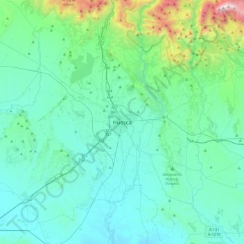
Naam: Topografische kaart Huesca, hoogte, reliëf.
Gemiddelde hoogte: 589 m
Minimale hoogte: 343 m
Maximale hoogte: 2.062 m