
Topografische kaart Narni
Interactieve kaart
Klik op de kaart om de hoogte weer te geven.
Narni
Narni (Latin: Narnia) is an ancient hilltown and comune of Umbria, in central Italy, with 19,252 inhabitants (2017). At an altitude of 240 metres (790 ft), it overhangs a narrow gorge of the Nera River in the province of Terni. It is very close to the geographic center of Italy. There is a stone on the exact spot with a sign in multiple languages.
Over deze kaart
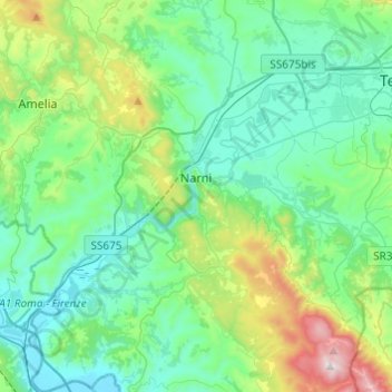
Naam: Topografische kaart Narni, hoogte, reliëf.
Locatie: Narni, Terni, Umbria, 05035, Italy (42.42158 12.41137 42.60082 12.61466)
Gemiddelde hoogte: 250 m
Minimale hoogte: 42 m
Maximale hoogte: 1.017 m
Andere topografische kaarten
Klik op een kaart om zijn topografie, zijn hoogte en zijn reliëf te bekijken.