
Topografische kaart Grand Falls
Interactieve kaart
Klik op de kaart om de hoogte weer te geven.
Over deze kaart
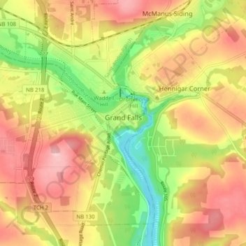
Naam: Topografische kaart Grand Falls, hoogte, reliëf.
Locatie: Grand Falls, Victoria County, New Brunswick, Canada (47.02299 -67.79020 47.06722 -67.71237)
Gemiddelde hoogte: 178 m
Minimale hoogte: 86 m
Maximale hoogte: 255 m
Andere topografische kaarten
Klik op een kaart om zijn topografie, zijn hoogte en zijn reliëf te bekijken.
Aroostook
Canada > New Brunswick > Victoria County > Aroostook
Aroostook, Andover Parish, Victoria County, New Brunswick, Canada
Gemiddelde hoogte: 142 m
Fox Ridge
Canada > New Brunswick > Victoria County
Fox Ridge, Gordon Parish, Victoria County, New Brunswick, Canada
Gemiddelde hoogte: 511 m