
Topografische kaart Vilafranca / Villafranca del Cid
Interactieve kaart
Klik op de kaart om de hoogte weer te geven.
Over deze kaart
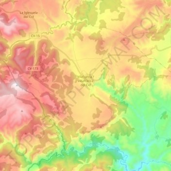
Naam: Topografische kaart Vilafranca / Villafranca del Cid, hoogte, reliëf.
Gemiddelde hoogte: 1.127 m
Minimale hoogte: 595 m
Maximale hoogte: 1.653 m