
Topografische kaart Sungai Rasau
Interactieve kaart
Klik op de kaart om de hoogte weer te geven.
Over deze kaart
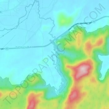
Naam: Topografische kaart Sungai Rasau, hoogte, reliëf.
Locatie: Sungai Rasau, Kampung Bukit, Pasir Puteh, Kelantan, Malaysia (5.73463 102.36410 5.78557 102.37710)
Gemiddelde hoogte: 98 m
Minimale hoogte: 13 m
Maximale hoogte: 372 m