
Topografische kaart Stella
Interactieve kaart
Klik op de kaart om de hoogte weer te geven.
Over deze kaart
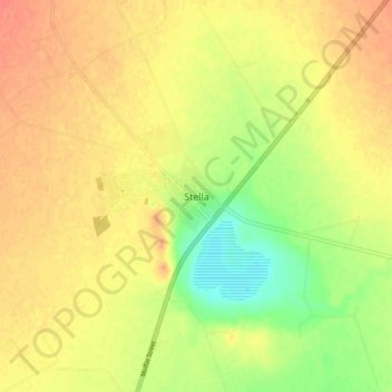
Naam: Topografische kaart Stella, hoogte, reliëf.
Gemiddelde hoogte: 1.303 m
Minimale hoogte: 1.276 m
Maximale hoogte: 1.319 m
Andere topografische kaarten
Klik op een kaart om zijn topografie, zijn hoogte en zijn reliëf te bekijken.
Vryburg
South Africa > North West > Dr Ruth Segomotsi Mompati District Municipality > Naledi Local Municipality
Vryburg, Naledi Local Municipality, Dr Ruth Segomotsi Mompati District Municipality, North West, 8600, South Africa
Gemiddelde hoogte: 1.205 m