
Topografische kaart Glasgow
Interactieve kaart
Klik op de kaart om de hoogte weer te geven.
Over deze kaart
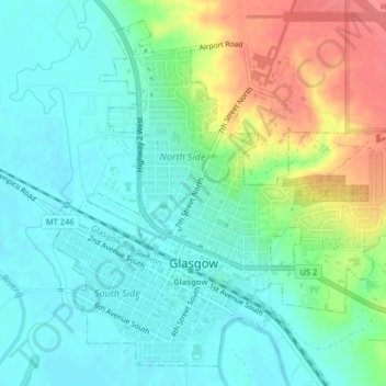
Naam: Topografische kaart Glasgow, hoogte, reliëf.
Locatie: Glasgow, Valley County, Montana, 59230, United States (48.18836 -106.65042 48.21255 -106.61272)
Gemiddelde hoogte: 654 m
Minimale hoogte: 633 m
Maximale hoogte: 700 m
According to the United States Census Bureau, the city has a total area of 1.43 square miles (3.7 km2), all of it land. The town has an elevation of 2,093 feet (638 m) and is nestled in the Milk River Valley.