
Topografische kaart Blue Knob
Interactieve kaart
Klik op de kaart om de hoogte weer te geven.
Blue Knob
Blue Knob (elevation 3,146 feet (959 m)) is a summit in the eastern United States with a broad dome that is the northernmost 3,000-footer in the Allegheny Mountains. It is the highest point in Bedford County, Pennsylvania.
Over deze kaart
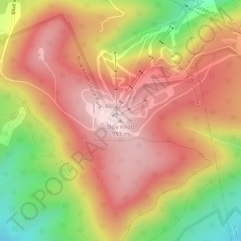
Naam: Topografische kaart Blue Knob, hoogte, reliëf.
Gemiddelde hoogte: 792 m
Minimale hoogte: 546 m
Maximale hoogte: 957 m