
Topografische kaart Brunswick
Interactieve kaart
Klik op de kaart om de hoogte weer te geven.
Brunswick
The city is the lowest in the state of Georgia, with an elevation of only 10 to 14 feet (3.0 to 4.3 m) above sea level. According to the U.S. Census Bureau, Brunswick's land area is 32.4 square miles (83.8 km2). Its total area is 42.4 square miles (109.8 km2); 10.0 square miles (26.0 km2) of this is water.
Over deze kaart
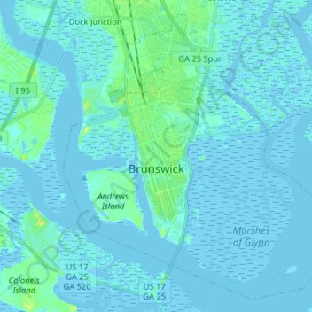
Naam: Topografische kaart Brunswick, hoogte, reliëf.
Gemiddelde hoogte: 2 m
Minimale hoogte: -3 m
Maximale hoogte: 22 m