
Topografische kaart Guéret
Interactieve kaart
Klik op de kaart om de hoogte weer te geven.
Guéret
Guéret has an oceanic climate (Köppen Cfb) influenced by its elevation and proximity to the Bay of Biscay's maritime inflow of Gulf Stream air. As a result, the climate is mild for its latitude, wet and also relatively gloomy.
Over deze kaart
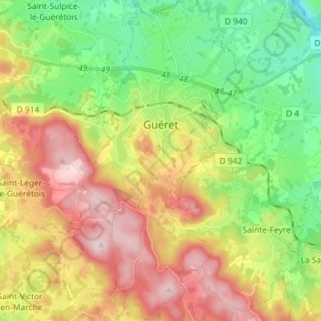
Naam: Topografische kaart Guéret, hoogte, reliëf.
Gemiddelde hoogte: 473 m
Minimale hoogte: 308 m
Maximale hoogte: 689 m