
Topografische kaart Kat River
Interactieve kaart
Klik op de kaart om de hoogte weer te geven.
Over deze kaart
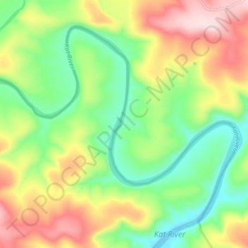
Naam: Topografische kaart Kat River, hoogte, reliëf.
Gemiddelde hoogte: 362 m
Minimale hoogte: 240 m
Maximale hoogte: 537 m
Andere topografische kaarten
Klik op een kaart om zijn topografie, zijn hoogte en zijn reliëf te bekijken.
Fort Fordyce Nature Reserve
RSA > Eastern Cape > Nkonkobe Local Municipality
Fort Fordyce Nature Reserve, Nkonkobe Ward 8, Nkonkobe Local Municipality, Amathole District Municipality, Eastern Cape, RSA
Gemiddelde hoogte: 963 m
Gaika’s Kop
RSA > Eastern Cape > Nkonkobe Local Municipality
Gaika’s Kop, Nkonkobe Local Municipality, Amathole District Municipality, Eastern Cape, RSA
Gemiddelde hoogte: 1.583 m