
Topografische kaart Willingdon Island
Interactieve kaart
Klik op de kaart om de hoogte weer te geven.
Over deze kaart
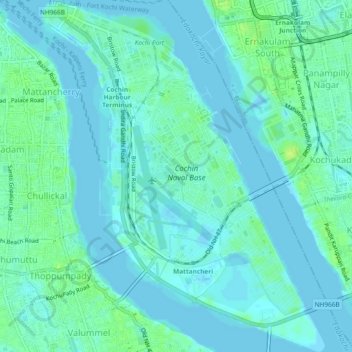
Naam: Topografische kaart Willingdon Island, hoogte, reliëf.
Locatie: Willingdon Island, Kochi, Ernakulam District, Kerala, India (9.92480 76.25738 9.97083 76.29524)
Gemiddelde hoogte: 4 m
Minimale hoogte: -3 m
Maximale hoogte: 15 m
Andere topografische kaarten
Klik op een kaart om zijn topografie, zijn hoogte en zijn reliëf te bekijken.