
Doe een donatie
Rust jezelf uit voor je volgende avontuur:
Als Amazon-partner verdient deze site een commissie op in aanmerking komende aankopen, zonder extra kosten voor jou.
Topografische kaart Broken Islands
Klik op de kaart om de hoogte weer te geven.
Doe een donatie
Rust jezelf uit voor je volgende avontuur:
Als Amazon-partner verdient deze site een commissie op in aanmerking komende aankopen, zonder extra kosten voor jou.
Over deze kaart
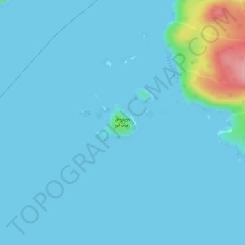
Naam: Topografische kaart Broken Islands, hoogte, reliëf.
Gemiddelde hoogte: 10 m
Minimale hoogte: 0 m
Maximale hoogte: 120 m
Doe een donatie
Rust jezelf uit voor je volgende avontuur:
Als Amazon-partner verdient deze site een commissie op in aanmerking komende aankopen, zonder extra kosten voor jou.
Andere topografische kaarten
Klik op een kaart om zijn topografie, zijn hoogte en zijn reliëf te bekijken.
Quadra Island
Canada > British Columbia > Strathcona Regional District > Area B (Discovery Islands/Mainland Inlets)
Gemiddelde hoogte: 128 m
Sonora Island
Canada > British Columbia > Strathcona Regional District > Area B (Discovery Islands/Mainland Inlets)
Gemiddelde hoogte: 186 m
Bute Inlet
Canada > British Columbia > Strathcona Regional District > Area B (Discovery Islands/Mainland Inlets)
The Bute Inlet route was later considered for the mainline of the Canadian Pacific Railway (CPR), which would have seen extensive blasting down the west shore of the inlet and a series of bridges to reach Vancouver Island near Campbell River via Seymour Narrows. This route was passed over in favour of the…
Gemiddelde hoogte: 921 m
Whiterock Passage
Canada > British Columbia > Strathcona Regional District > Area B (Discovery Islands/Mainland Inlets)
Gemiddelde hoogte: 174 m
Doe een donatie
Rust jezelf uit voor je volgende avontuur:
Als Amazon-partner verdient deze site een commissie op in aanmerking komende aankopen, zonder extra kosten voor jou.
East Redonda Island
Canada > British Columbia > Strathcona Regional District > Area B (Discovery Islands/Mainland Inlets)
Gemiddelde hoogte: 327 m
Quathiaski Cove
Canada > British Columbia > Strathcona Regional District > Area B (Discovery Islands/Mainland Inlets)
Gemiddelde hoogte: 40 m
Hardwicke Island
Canada > British Columbia > Strathcona Regional District > Area B (Discovery Islands/Mainland Inlets)
Gemiddelde hoogte: 132 m
Mount Bute
Canada > British Columbia > Strathcona Regional District > Area B (Discovery Islands/Mainland Inlets)
Gemiddelde hoogte: 1.993 m
Doe een donatie
Rust jezelf uit voor je volgende avontuur:
Als Amazon-partner verdient deze site een commissie op in aanmerking komende aankopen, zonder extra kosten voor jou.
Heriot Bay
Canada > British Columbia > Strathcona Regional District > Area B (Discovery Islands/Mainland Inlets) > Heriot Bay
Gemiddelde hoogte: 44 m
Mount Hayes
Canada > British Columbia > Strathcona Regional District > Area B (Discovery Islands/Mainland Inlets)
Gemiddelde hoogte: 1.101 m
Heriot Bay
Canada > British Columbia > Strathcona Regional District > Area B (Discovery Islands/Mainland Inlets)
Gemiddelde hoogte: 38 m
Yorke Island
Canada > British Columbia > Strathcona Regional District > Area B (Discovery Islands/Mainland Inlets)
Gemiddelde hoogte: 9 m
Doe een donatie
Rust jezelf uit voor je volgende avontuur:
Als Amazon-partner verdient deze site een commissie op in aanmerking komende aankopen, zonder extra kosten voor jou.
Jackson Bay
Canada > British Columbia > Strathcona Regional District > Area B (Discovery Islands/Mainland Inlets)
Gemiddelde hoogte: 118 m
Mount Raleigh
Canada > British Columbia > Strathcona Regional District > Area B (Discovery Islands/Mainland Inlets)
Mount Raleigh, elevation 3,132 m (10,276 ft), is one of the principal summits of the Pacific Ranges of the Coast Mountains of southern British Columbia in Canada. It is located just southeast of the confluence of the Southgate and Bishop Rivers, northeast of the head of Bute Inlet, and is the highest summit…
Gemiddelde hoogte: 2.414 m
Quadra Island
Canada > British Columbia > Strathcona Regional District > Area B (Discovery Islands/Mainland Inlets)
Gemiddelde hoogte: 128 m
Discovery Mountain
Canada > British Columbia > Strathcona Regional District > Area B (Discovery Islands/Mainland Inlets)
Gemiddelde hoogte: 361 m
Doe een donatie
Rust jezelf uit voor je volgende avontuur:
Als Amazon-partner verdient deze site een commissie op in aanmerking komende aankopen, zonder extra kosten voor jou.
Ripple Rock
Canada > British Columbia > Strathcona Regional District > Area B (Discovery Islands/Mainland Inlets)
Gemiddelde hoogte: 40 m
Pembroke Range
Canada > British Columbia > Strathcona Regional District > Area B (Discovery Islands/Mainland Inlets)
Gemiddelde hoogte: 633 m