

Topografische kaart Siliguri
Klik op de kaart om de hoogte weer te geven.
Siliguri
Siliguri located at the foothills of the eastern Himalayas at a location of 26°43′N 88°26′E / 26.71°N 88.43°E / 26.71; 88.43. This city is spread over an area of 260 km2 within the Siliguri Corridor, also known as the Chicken's neck. The city is surrounded by dense forests towards north and lifeline of Siliguri, Mahananda River flows through the city thereby bisecting it into two-halves. Also Teesta river is not so far from the city. Siliguri has an average elevation of 122 metres (400 feet). As Siliguri is located in the Terai region, the soil is sandy in nature i.e. the ratio of sand and silt is much higher than clay. This region is very prone to earthquake as there are several fault lines nearby. The Siliguri subdivision is surrounded by Himalayan ranges towards north and towards south by the country Bangladesh, Uttar Dinajpur district of West Bengal and the Indian state of Bihar. On the east lies Jalpaiguri district and Kalimpong district and bounded on the west by the country of Nepal, thus strategically so important.
Over deze kaart
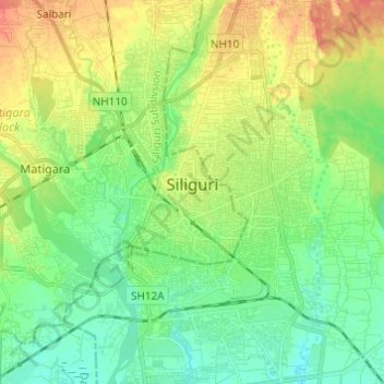
Naam: Topografische kaart Siliguri, hoogte, reliëf.
Locatie: Siliguri, Matigara block, Darjeeling, West Bengal, India (26.65977 88.39810 26.76843 88.46876)
Gemiddelde hoogte: 121 m
Minimale hoogte: 102 m
Maximale hoogte: 150 m