
Topografische kaart Indravati National Park
Interactieve kaart
Klik op de kaart om de hoogte weer te geven.
Over deze kaart
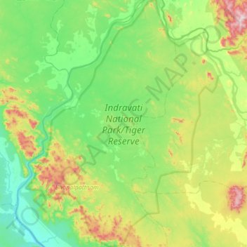
Naam: Topografische kaart Indravati National Park, hoogte, reliëf.
Gemiddelde hoogte: 253 m
Minimale hoogte: 90 m
Maximale hoogte: 732 m
The topography of the park mainly comprises undulating hilly terrain with altitude ranging between 177 and 599 metres above the sea level.
Andere topografische kaarten
Klik op een kaart om zijn topografie, zijn hoogte en zijn reliëf te bekijken.
Bhairamgarh Tahsil
India > Chhattisgarh > Bijapur District
Bhairamgarh Tahsil, Bijapur District, Chhattisgarh, India
Gemiddelde hoogte: 386 m