
Topografische kaart 2
Interactieve kaart
Klik op de kaart om de hoogte weer te geven.
Over deze kaart
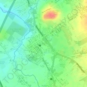
Naam: Topografische kaart 2, hoogte, reliëf.
Locatie: 2, Santo Tomas, Batangas, Calabarzon, 4234, Philippines (14.10685 121.14070 14.11108 121.14707)
Gemiddelde hoogte: 143 m
Minimale hoogte: 118 m
Maximale hoogte: 179 m
Andere topografische kaarten
Klik op een kaart om zijn topografie, zijn hoogte en zijn reliëf te bekijken.
3
Philippines > Batangas > Santo Tomas
3, Santo Tomas, Batangas, Calabarzon, 4234, Philippines
Gemiddelde hoogte: 140 m
San Lucas
Philippines > Batangas > Santo Tomas > San Lucas
San Lucas, Santo Tomas, Batangas, Calabarzon, 4234, Philippines
Gemiddelde hoogte: 289 m