
Topografische kaart Ashbourne CP
Interactieve kaart
Klik op de kaart om de hoogte weer te geven.
Ashbourne CP
Ashbourne lies at 53°01′N 01°44′W / 53.017°N 1.733°W / 53.017; -1.733. Ashbourne Green and Sturston are hamlets close by. Henmore Brook, a tributary of the River Dove, flows through the middle of the town. It has an elevation of 400 feet (122 m).
Over deze kaart
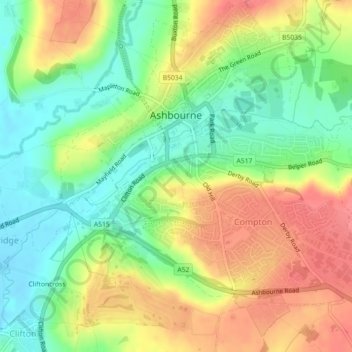
Naam: Topografische kaart Ashbourne CP, hoogte, reliëf.
Gemiddelde hoogte: 147 m
Minimale hoogte: 112 m
Maximale hoogte: 187 m
Andere topografische kaarten
Klik op een kaart om zijn topografie, zijn hoogte en zijn reliëf te bekijken.